RAIN: Innovative approaches to flood resilience

HR Wallingford is working in collaboration with the RAIN project partners to develop and trial innovative flood risk measures for communities located in the Harpers Brook and Wootton Brook catchments in Northamptonshire. Funded by the UK Government’s Flood and Coastal Resilience Innovation fund, RAIN is one of 25 projects nationwide learning and developing new approaches to improve flood resilience and manage flood risk over a six year programme.
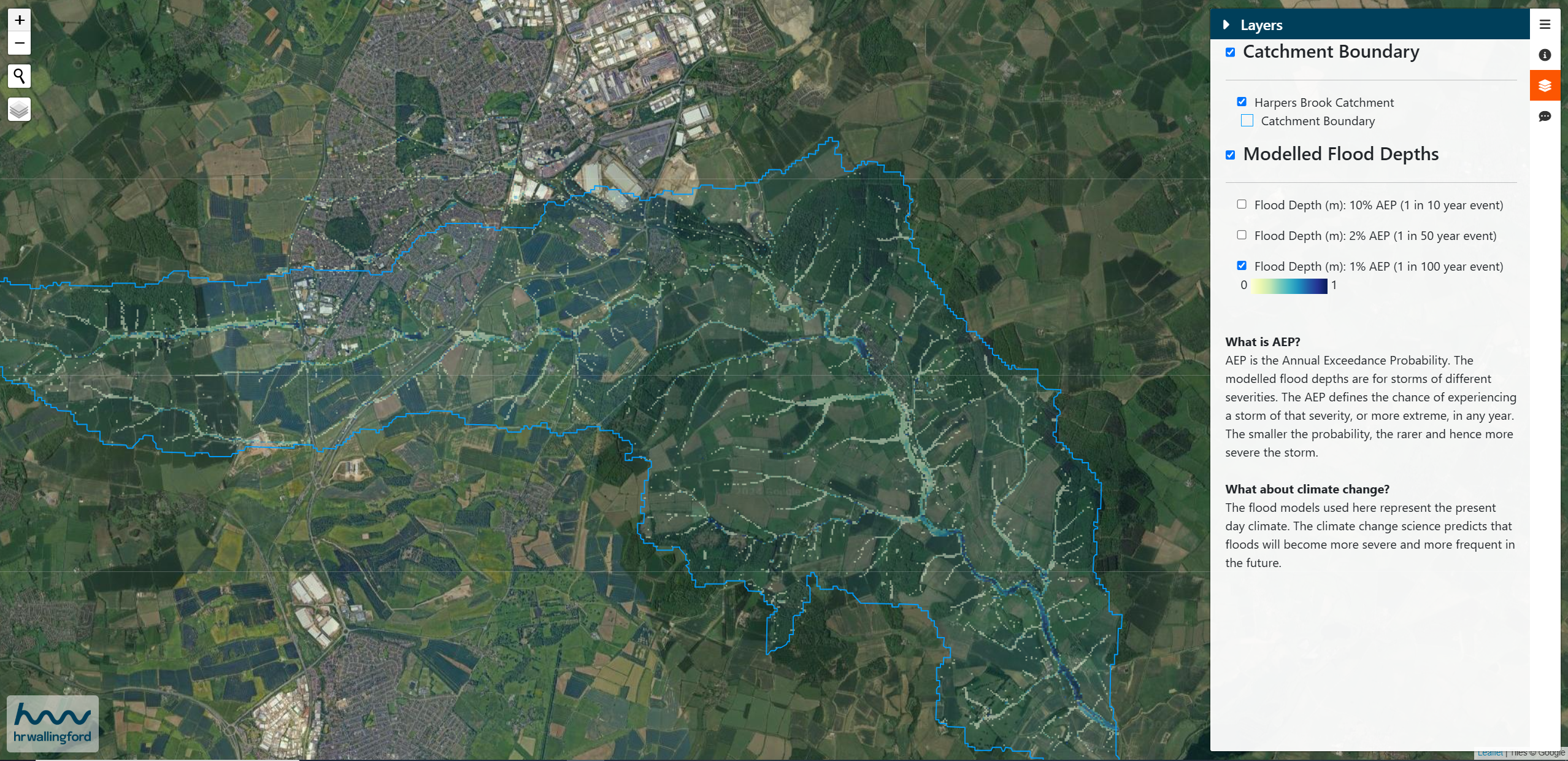
Building a hydraulically connected multi-source flood model
here have been more than 350 floods reported in the Wootton Brook and Harpers Brook catchments since 2012. These have been from several flooding sources, including river, surface water, urban drainage and a combination of these.
We developed an innovative, high-resolution flood model to hydraulically combine the hazard from all these sources to capture their interaction. This significant improvement over more traditional modelling approaches was supported by close collaboration on the project enabling the sharing of models and data from the Environment Agency, West Northamptonshire Council and Anglian Water.
Our new multi-source model allows us to better understand the interaction between these different systems during flood events and has enabled us to develop new thinking on how to build effective resilience using a combination of measures.
RAIN won the prestigious Digital Excellence category at the Flood & Coast Excellence Awards 2024, recognising the innovation in flood modelling and online collaboration.
Natural flood management
Through collaboration between different organisations, land-owners, farmers and communities, a range of natural flood management options were identified for each catchment. Our multi-source flood model has been used to assess the potential reduction in flood depth that these measures achieve and the risk reduction benefits they could deliver.
The results have been used to plan the distribution of the natural flood management measures with several already installed and others in the planning stage and soon to follow.
Property flood resilience (PFR)
Using our multi-source flood model, we calculated the flood risk to every property in both catchments and evaluated the benefit of implementing PFR resistance measures to each (e.g. flood doors). We found that the reduction in damage to 200 properties had a benefit-cost ratio of at least 6:1. In other words, for every pound spent on property flood resilience, the property owner would save at least £6 in avoided flood damage costs.
These results are being used to target a programme of support and offer PFR measures where they provide the greatest benefit to the communities.
Interactive web portals fostering collaboration
We supported collaboration amongst the project team by developing a web-based workspace to share the latest interactive maps of model results and PFR benefits. Through effective teamwork, including input from PFR scheme delivery experts, properties were prioritised for door-to-door interviews with homeowners to arrange free PFR surveys. The web portal was also used to keep track of progress using the mapping and dashboard.
We also enabled participation and engagement from the local communities by developing public-facing websites. Residents can click on the map and fill in information on their valuable knowledge of historic flooding.
Click in the image below to explore the public engagement site for Harpers Brook.
The RAIN project demonstrates how the innovative use of technology can help to identify communities at risk of flooding from multiple sources and can support knowledge sharing and collaboration to build more climate-resilient communities.
The bigger picture
RAIN provides evidence of how different interventions work together across catchments. Not only will it help communities in Northamptonshire, it feeds into national flood risk management by helping us to better understand the causes of flooding by modelling the interaction between surface water, urban drainage and river systems, a significant step towards the Environment Agency’s objective of integrated “all source” flood modelling, currently targeted for 2040.
Contact our project lead
Mike Panzeri


