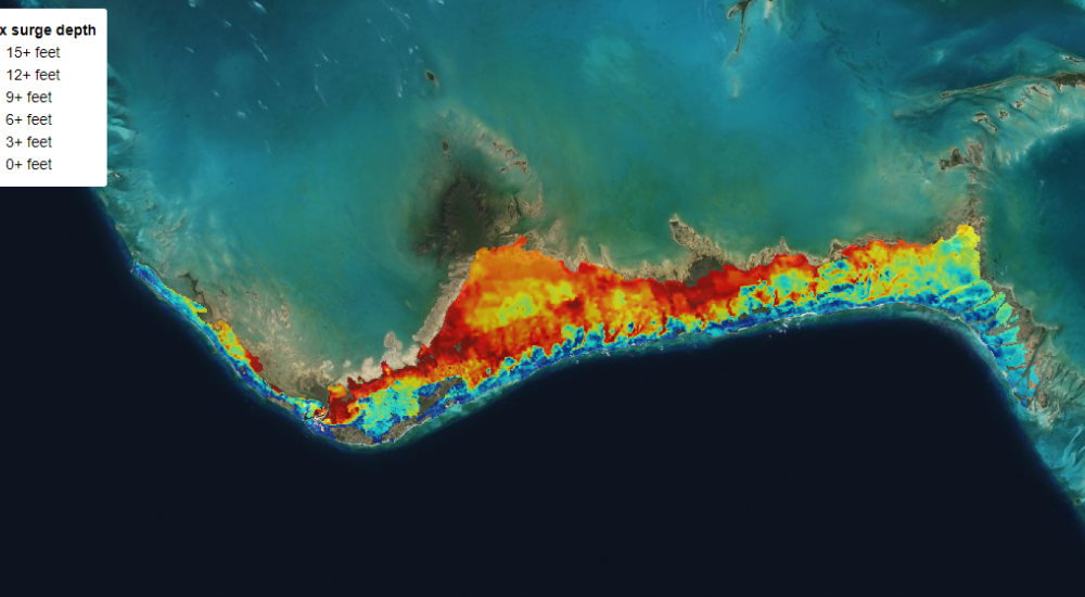
Storm Surge Atlas brings hope to hurricane-hit islands
As low-lying islands learn to live with climate change, a new way of predicting flooding caused by extreme weather has been successfully trialled in The Bahamas. Scientists at HR Wallingford have developed a ‘Storm Surge Atlas’ for the government and people of The Bahamas that will help protect lives and livelihoods in the country.
“We’re out of time” said the Hon. Philip Davis, prime minister of The Bahamas in a rousing speech at COP26 last year. And he is right – climate change will increase the likelihood of flooding in The Bahamas because of rising sea levels and an increase in severe hurricanes.
In fact, the Storm Surge Atlas predicts that severe flooding may be up to twice as likely in 2055 and three times as likely in 2100 as it is today.
However, whilst the outlook might look dire, the atlas will help The Bahamas turn back the clock. The information it contains will help the low-lying country to plan for major incidents, build flood defences and ensure that developments are in safe places.

The scientists behind the work would like to see storm surge atlases help build climate resilience in other vulnerable communities.
Dr Stephen Grey, a principal scientist at HR Wallingford said: “More serious storm surges are an inevitable consequence of climate change. We can’t stop the flooding, but we can help people to live with it. I truly hope that storm surge atlases will become commonplace wherever they are needed.”
When a storm causes the sea level to rise above normal levels, it’s known as a surge. It happens because winds from hurricanes push along the sea’s surface. Surges get bigger when land or shallow seabeds slow them down and if they get higher than the land, lead to flooding.
To create the atlas, the HR Wallingford team analysed the paths, wind speeds and size of every hurricane in the region since 1970. They then simulated storm surges for 2000 artificial future hurricanes and displayed the extent and depth of predicted flooding in the new atlas.
The atlas was developed alongside a storm surge model that can be used as an early warning to predict flooding as hurricanes come in. The storm surge model covers all of The Bahamas extending as far as Cuba in the South, Florida in the west, and around 200 miles out into the North Atlantic.
The atlas currently covers Grand Bahama and Eleuthera, with plans to extend to the rest of the archipelago.
Want to know more?

