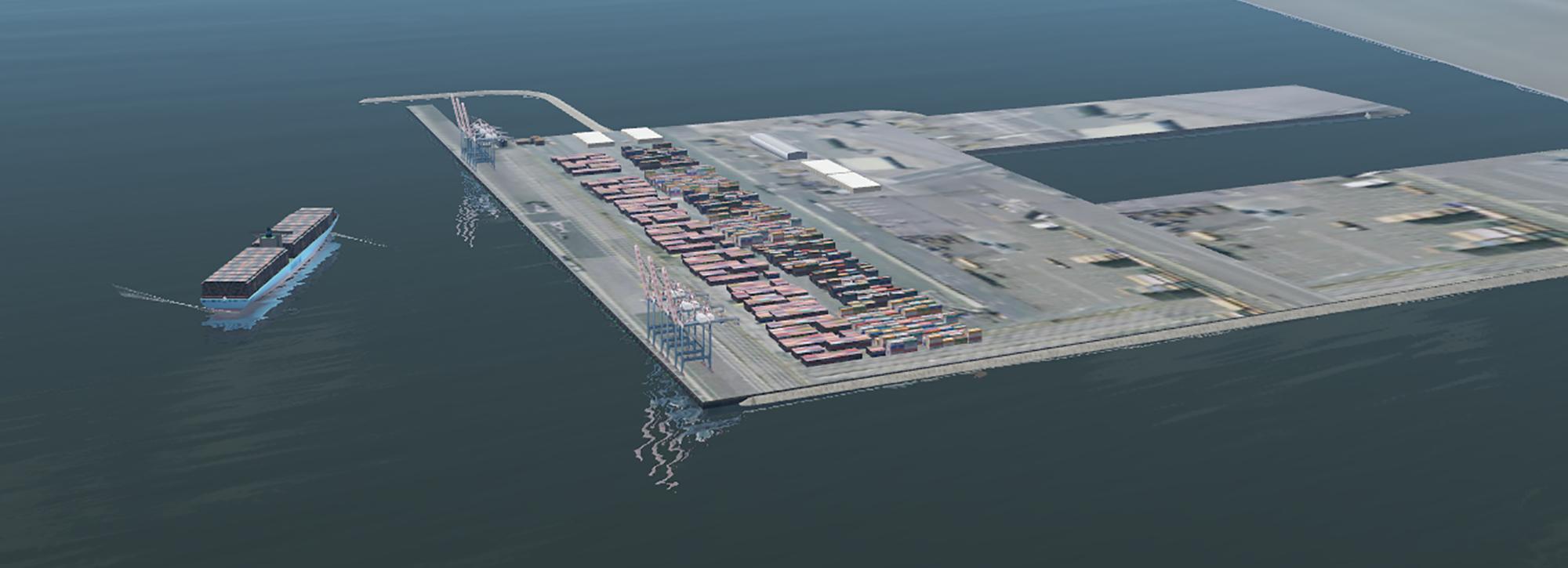
Developing a mega port for Kuwait
The Mubarak Al-Kabeer port project, now under construction, brought together many of HR Wallingford’s core activities for port studies: navigation, ship motion, siltation and dredging. The mix of studies linking numerical and physical modelling was a strength of our approach.
Development of the port master plan
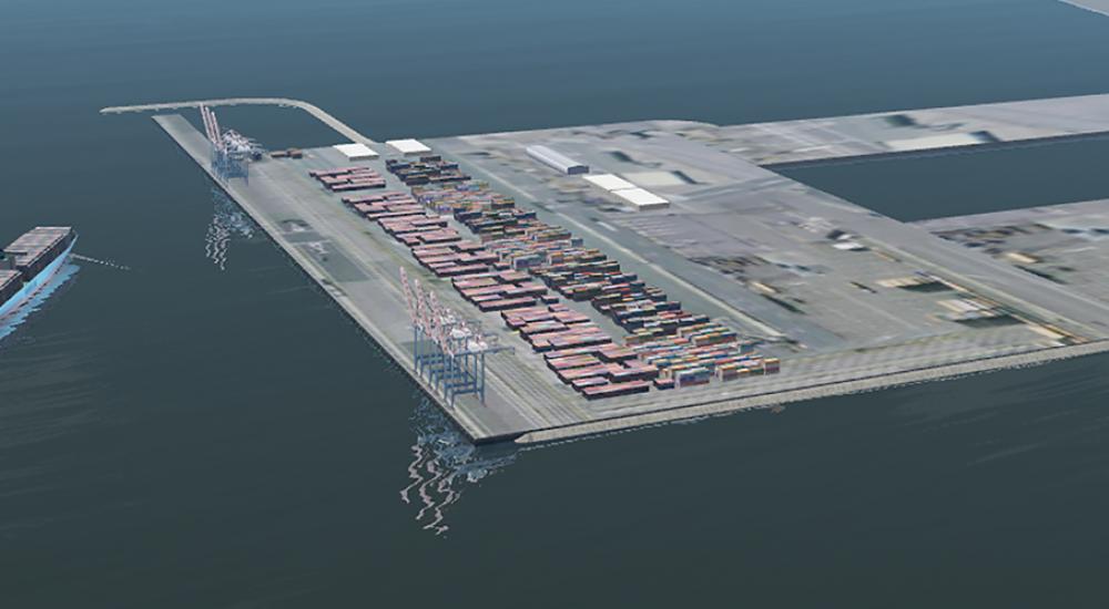
HR Wallingford first became involved in the Mubarak Al-Kabeer port project in 2006, supporting the development of the port master plan. The port plan is part of an overall master plan for Boubyan island, the largest of Kuwait’s islands, at approximately 850 square kilometres, including residential and industrial developments with a new improved bridge link to the mainland an onto Kuwait City. Within the master plan half of the island is to be designated as a nature reserve due to its environmental sensitivity.
The project to create a port on Boubyan Island is complex, not only because the island is uninhabited and made up almost entirely of soft muddy flats called Sabkha, but also because of its proximity to the nearby international border.
Designing and confirmation
HR Wallingford worked on the detailed design studies for phases one and two of the port and the confirmation of the design concept of subsequent phases, supporting the main contractors Hyundai and their design and environmental consultants. We provided a programme of modelling and assessment services for the port design and environmental impact assessment (EIA). This support was provided through a series of desk assessments, expert analysis and modelling studies looking in to siltation, dredging and metocean studies as well as specific, key issues for the operation of the port, such as vessel movement at berth, wave overtopping of the quay and flushing of the small vessel harbour.
The Mubarak Al-Kabeer port project, now under construction, brought together many of HR Wallingford’s core activities for port studies – sedimentation, navigation, design and dredging.
Fast track approach to deliver the project on time
To enable the project to be delivered on time the modelling studies were conducted in parallel. The modelling tools were used to refine the layout of the port to reduce the predicted siltation and maintenance dredging requirements. These tools were also used to formulate longer term predictions of the environmental conditions at the site. The extent of the development meant regional scale investigations were required to understand the primary environmental forces, their effect on the port and the potential for the port to change these forces. As it is an almost virgin site there is very little historic data to refer to.
Further studies on the route and design of the approach channel and link channel to the port were completed in 2017. This involved an options investigation for a route for the 50 km of approach channel to link the port site with the gulf. Further surveying, analysis and modelling re expected to be undertaken in the development of the alternative channel design. For the link channel an inter-comparison of three options was undertaken including an assessment of the likely capital dredging methodology and cost.
Allied to the port engineering studies, HR Wallingford has also been instrumental in providing an innovative solution to training port staff by setting up a real time navigation simulation facility to represent phase one of the development. This facility will allow a pilot training plan to be established before the port is even built. This facility was updated as part of the alternative channel alignment studies and used as a design tool to test the alternative link channel options
Innovative solutions to training port staff
Allied to the port engineering studies, HR Wallingford has also been instrumental in providing an innovative solution to training port staff by setting up a real time navigation simulation facility to represent phase one of the development. This facility will allow a pilot training plan to be established before the port is even built. This facility will also be updated as part of the alternative channel alignment studies.
An overall master plan for Boubyan island, Kuwait's largest island
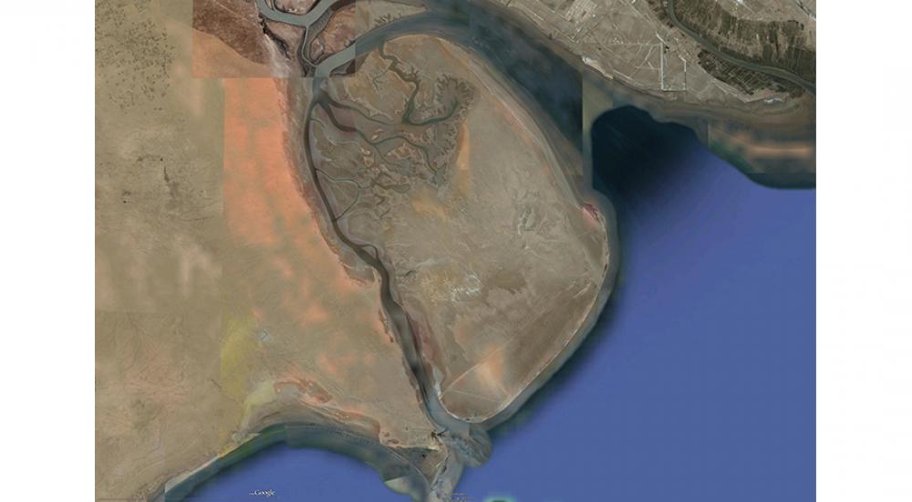
The port plan is part of an overall master plan for Boubyan island, the largest of Kuwait’s islands.
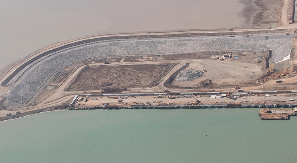
The small vessel harbour under construction within the reclaimed area
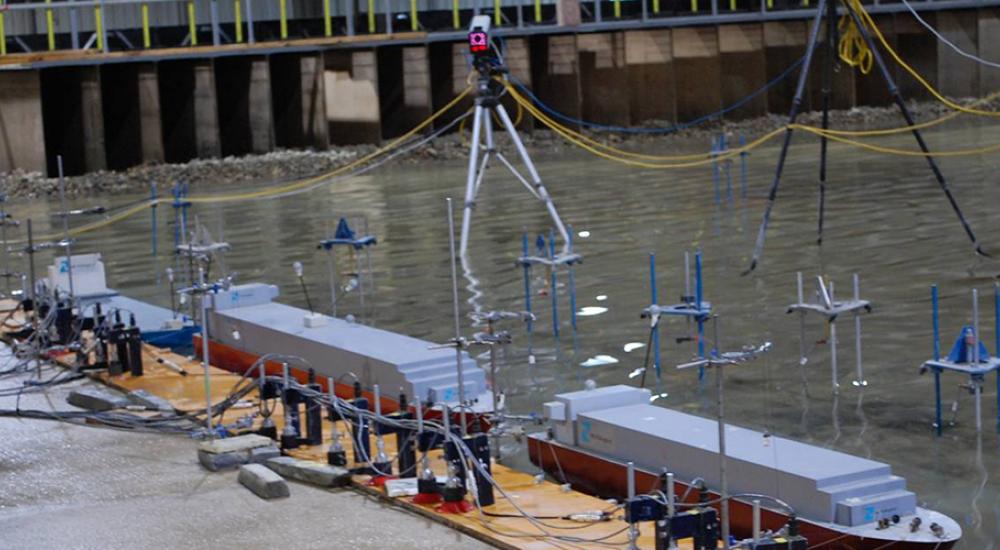
Our detailed studies including ship mooring analysis in our physical modelling facilities
Navigation studies and innovative training in our ship simulation centre
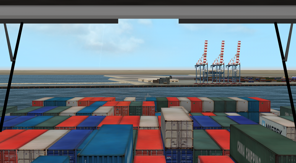
View from the bridge on our ship simulator.
Want to know more?